Mount Hymettus
Trail 9 · Path 18
- Walking time
≈ 1 h 30 Running it? Set your pace - Distance
- 2.2 km
- Ascent
348 m - Descent
0 m - Highest point
716 m
- Up to 3 h
- A mountain path, steep in places. You need steady footing and hiking shoes. All grades
Tap at the start Fire season: check tomorrow's risk map - Volunteers recorded the line and the waymarks in OpenStreetMap. We took the data on 13 October 2026. We don't know who looks after the trail today, so ask in the village or at the refuge what state it's in. The route on OpenStreetMap ↗What the sources mean
The Monastery of Timios Prodromos at Kareas · 60 m from the trail, near km 0.6
Route
needs carerace course
- Slope
- < 8%
- 8–15%
- > 15%
Water point
Getting there
The trail starts at 364 m. Nearest village or town: Ilioupoli, 2.2 km from the start. 37.94213, 23.77761
The Monastery of Timios Prodromos at Kareas · 60 m from the trail, near km 0.6
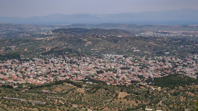
Kareas from the mountain · 100 m from the trail, near its start
From Wikimedia Commons, taken within 150 m of the trail and picked one by one. Tap a photo for the photographer and licence.
Expect runners on race mornings. The km are counted on each race's course.
Grand Trail Hymettus
Paiania, Mt Hymettus 103 km · 5,400 m D+ 37 km · 2,180 m D+ 22 km · 1,400 m D+ 11 km · 600 m D+ - GTH 100+ · km 35–38 of the course
Ymittos Marathon
Argyroupoli, Mt Hymettus 47 km · 2,150 m D+ 28 km · 1,450 m D+ 18 km · 470 m D+ 10 km · 340 m D+ 5 km · 170 m D+ - Sfittia 47K · km 36–38 of the course
- Sessi 28K · km 17–19 of the course