Agrafa
Trail 64 · Agios Nikolaos Vlasiou
- Walking time
≈ 6 h 50 Running it? Set your pace - Distance
- 13.3 km
- Ascent
950 m - Descent
959 m - Highest point
2,109 m
- Over 5 h
Water only 190 m off the trail, at km 3.5 Fire season: check tomorrow's risk map - Marked and maintained by EOS Karditsa, according to its own page, which we read on 20 October 2026. In 2016 the club wrote that it was building the Karditsa Agrafa network. We don’t know when the marks on this trail were last renewed. Their page ↗What the sources mean
The trig pillar on the summit of Templa (1,808 m) in snow, the lake far below, 16 January 2011 · on the trail at km 1.7
Route
needs carerace course
- Slope
- < 8%
- 8–15%
- > 15%
Summit
Getting there
The trail starts at 1,522 m. Nearest village or town: Rafina, 1.4 km from the start. 39.27915, 21.68305
The trig pillar on the summit of Templa (1,808 m) in snow, the lake far below, 16 January 2011 · on the trail at km 1.7
The Agios Nikolaos chapel above Vlasi in snow, February 2019. The A1 to Karava starts here · on the trail, at its end
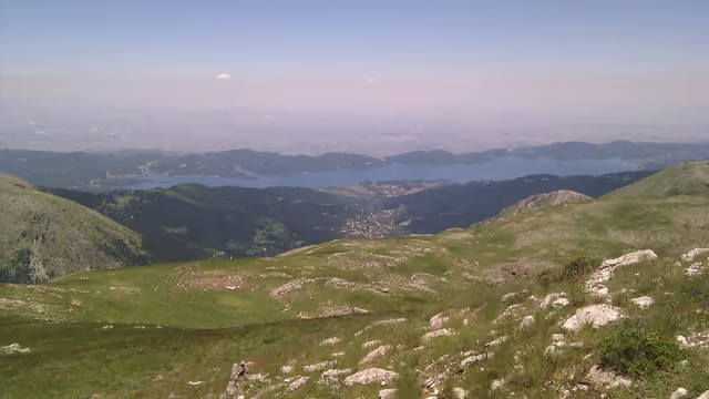
The lake from the summit of Moutsiara (2,120 m), June 2011 · on the trail at km 6.4
From Wikimedia Commons, taken within 150 m of the trail and picked one by one. Tap a photo for the photographer and licence.
Expect runners on race mornings. The km are counted on each race's course.
Lake Plastiras Trail
Lake Plastira, Karditsa, Agrafa 42 km · 2,400 m D+ 23 km · 1,150 m D+ 10 km · 100 m D+ 5 km · 200 m D+ 0.6 km - Lake Plastiras Trail 42K · km 27–29, 29–31 of the course
- Lake Plastiras Trail 23K · km 13–16 of the course
Argithea Mountain Race
Petrilo, Argithea, Agrafa 30 km · 2,100 m D+ 15 km · 900 m D+ 3.6 km · 700 m D+ 5 km · 250 m D+ 1 km - Argithea Skyrace 30K (6 Peaks) · km 21–22 of the course